Anyone who sails knows the feeling: without sufficient planning, a passage can quickly descend into chaos. Digital tools make life on board considerably easier. Here are our favourite sailing apps for passage planning, navigation, weather and harbour information – all tried and tested on our travels.
Navigation & charts
Navionics
- Price varies depending on sailing area and number of charts – around 50 Euro per year
- In our sailing areas (central/northern Europe), the chart detail is excellent.
- Autorouting is usable, but always needs to be double-checked.
Skippo
- A good Navionics alternative for Scandinavia – we’ve used it in Sweden, Finland and Norway. Charts for Denmark cost extra.
- Price depends on the version (we use Smart): 30 Euro per year.
- You can also add Gästhamnsguiden content as an add-on, so you no longer need those expensive books.
- Autorouting is good, but always needs to be double-checked.
Weather & wind forecasts

Windy
- Free to use; the premium version costs around €25 per year.
- We use Premium for more detailed forecasts (1-hour intervals), longer-range forecasts and more frequent updates.
- The route planner feature is handy for longer passages: import the GPX from Navionics, enter your boat speed, and you’re good to go. To find the best weather window, we save the route and check back regularly for updates. When heading offshore without connectivity, grab a few screenshots beforehand.
Regional weather services & apps
Alongside Windy, we always consult local weather services as well – either via their websites or as installed apps:
- Norway: Yr.no and Barentswatch.no
- Sweden/Denmark: smhi.se and dmi.dk
- Netherlands: knmi.nl
Harbour & anchorage information
Noforeignland
- Fully free to use
- Our favourite app when we want to research harbours and anchorages in advance.
- We don’t pay anything for it, but we do contribute a lot of content in return – mainly photos and reviews.
- Also handy for staying in touch with friends and fellow sailors, and for documenting your own journey.
Harbourmaps
- We haven’t been using it for very long and are still testing it
- Subscription only, around €25 per year (with a short free trial)
- Lots of useful features, including wind shelter ratings by direction and topography
- Good search filters, e.g. by available facilities such as electricity, toilets, washing machines, etc.
Navily
- The free version is perfectly sufficient for us
- We use it to find suitable anchorages as an alternative to NFL.
Anchor watch
Anchor Sentry
- Available for iOS and Android
- Cost less than €5
- Support from the German developer is excellent.
- I’ve been using the app on iOS for 3 years. It runs on a dedicated device on board, and when we’re out and about we mirror the data to our phones.
Sailgrib AA
- Android only
- Subscription model; we’re currently testing the free version.
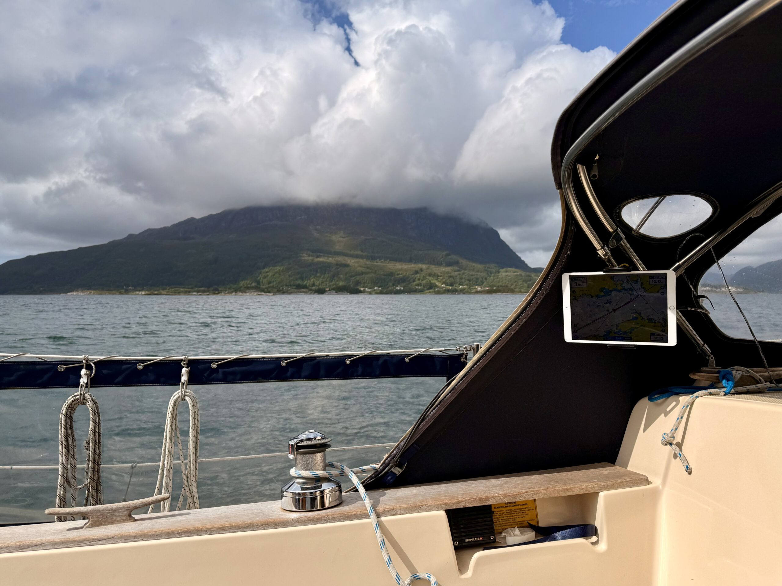
Hardware
- iPad (instead of a case, we just pull a plastic bag over it in heavy rain).
- Tablet mount for the cockpit
- Power bank
Final thoughts
Handy as they are, sailing apps are no substitute for good seamanship! You should never rely 100% on digital tools. For all the essentials, we’ve built in redundancy – for example, two anchor watches running simultaneously, and at least two different charts in separate apps, plus the chartplotter.